

Contact a PGS expert
Please contact a member of our AMME team for more information.
Exploration offshore Angola has seen a recent shift in exploration emphasis, with interest moving from postsalt sedimentary sequences to the presalt section.


To optimize seismic data quality and accuracy over target areas, PGS’ data library utilizes high-end imaging solutions to enhance resolution of the Mesozoic sedimentary architecture.
On the Kwanza Shelf, shallow water environments present an imaging challenge that can be resolved by enhanced processing flows. Multisensor recording enables high-resolution velocity model building and depth imaging using reflections, refractions, and multiples.
Primary reflections, as recorded by multi-sensor streamers, are used to resolve the long-wavelength velocity trend and shallow gradients using reflection tomography. The resulting velocity model is then used by Full Waveform Inversion (FWI) for further refinement. PGS FWI uses the full wavefield to overcome the restrictions posed by conventional reflection tomography and as such is able to successfully resolve small-scale velocity features.
The rich low frequencies of multi-sensor recordings help mitigate cycle-skipping in FWI, and enable a high-resolution velocity model to be built using both refractions and reflections.
Due to the lack of near offsets and angular illumination in areas of shallow water, conventional depth-migrated gathers and stacks are unsuitable for validating the shallow overburden model provided by FWI. SWIM creates high-resolution stack images and well-sampled angle gathers by using sea-surface reflections to complement primary reflection imaging. By using the separated up-going and down-going wavefields, uniquely recorded by multi-sensor streamers, SWIM provides enhanced subsurface illumination and improved angular coverage for shallow data.
PGS’ wavelet shift tomography (hyperTomo) is used with FWI to optimize presalt velocity model building, resulting in improved imaging and a greater understanding of geological complexity in areas such as Block 16. Wavelet shift tomography enables quick cycle velocity updates, using wavelet attributes and semi-automated inversion loops. PGS’ FWI algorithm inverts for the full wavefield, making use of both refractions and reflections for updating the velocity model. PGS has devised a modified Inverse Scattering Imaging Condition (ISIC) for FWI. It is based upon the ISIC in PGS RTM and removed the migration isochron from the velocity kernel. This prevents reflectivity leakage in the velocity model when updating sing deep reflections. FWI testing completed in parallel to hyperTomo updates allows for a seamless transition in the model-building workflow.
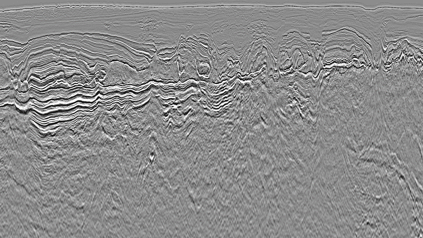
Salt interpretation for velocity model building can be time-consuming and costly. In areas such as Angola, this involves multiple RTMs and periods for interpretation. The addition of cross-departmental expertise and semi-automation of auxiliary information helps reduce the project turnaround.
The final RTM using PGS’ ISIC excludes the backscatter energy, producing an image using only the migration isochron. This removes low wavenumber noise that often contaminates RTM images, minimizing post-processing, and reducing the project turnaround. As RTM is not affected by ray-based limitations, top and base salt imaging is clearer and uncertainty in the underlying structure is reduced.
Please contact a member of our AMME team for more information.