

The latest edition of GeoExpro features a first look at the most recent PGS data from the Barents Sea. According to the Norwegian Petroleum Directorate almost half of the undiscovered resources on the Norwegian Continental Shelf are to be found in the Barents Sea.
The far southwestern Barents Sea is one of the few remaining frontier basins. There is little exploration activity and the data coverage is sparse. Until now, almost all existing seismic data was 2D, of variable data quality and as a result, the geology and hydrocarbon potential of the area is not fully understood.
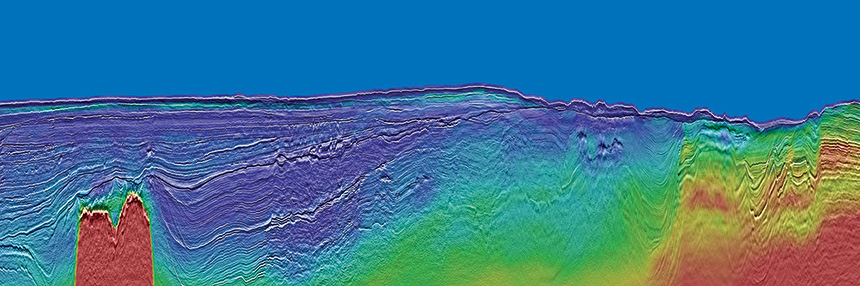
PGS has now covered parts of this area with the first 3D GeoStreamer MultiClient broadband seismic dataset (PGS17011NBS) to enhance the geological understanding of the area and as a tool for unlocking new potential in this virtually unexplored and exciting part of the Norwegian Barents Sea. Through advances in data acquisition and imaging, and building on experience of acquiring data in the Barents Sea, this newly acquired dataset illuminates the geology and the exploration potential.
The multisensor seismic survey was acquired in 2017 and is processed with an innovative workflow using complete wavefield imaging (CWI). This is a processing flow developed by PGS which integrates advanced technology for high-resolution velocity model building and depth imaging using reflections, refractions and multiples. The new high resolution 3D seismic data is revealing geological details never seen before in this area thanks to the acquired broadband data and the state-of-the-art imaging workflow.
Processing is now complete with a full suite of KPSDM products available. Read more by downloading the full article from our technical library.
Contact a PGS expert
Please contact a member of our Asia team for more information.