

A new model building process delivers reliable high-quality images beneath very complex and rugose salt bodies such as those in the Gulf of Mexico and offshore Brazil.
Producing reliable images beneath salt bodies is a challenge. The distortions to the seismic wavefields, introduced by local subsurface complexities, are so great, that meaningful images are entirely dependent on our ability to create a velocity model that sufficiently represents the actual salt geometry. Any divergence from the geometry results in a very rapid deterioration of the image quality for all layers beneath it.
Scenario testing of different salt geometries has been employed for some time. This aims to speed-up the model building process and ensure rapid convergence towards the best subsurface image. PGS has further advanced the salt scenario testing technique with a highly efficient and interactive workflow that uses the most accurate Reverse Time Migration (RTM) imaging technology available to date.
Real-time Quality Control
The new workflow combines holoSeis 3D visualization and interpretation capabilities with some of the most advanced imaging technology. These include RTM True Amplitude Angle Azimuth Gathers (TA3GS) along with quantitative QC, to assess the seismic image quality iteratively throughout the velocity model building process. Locations of substantial image uncertainty, caused by variable subsurface illumination effects, will be identified. These areas can then be targeted for velocity model improvement, focusing salt scenario testing efforts on areas that have the biggest uplift potential.
Benefits Beyond Image Improvements
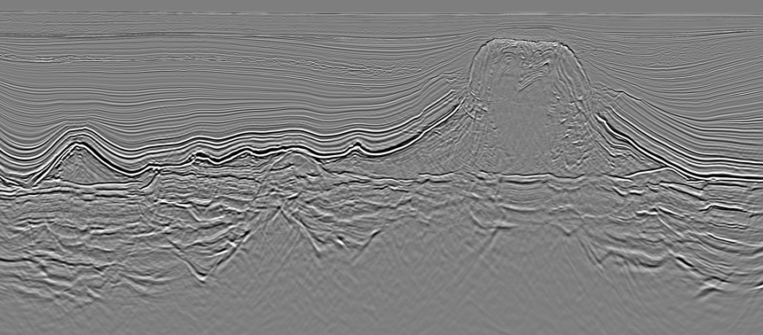
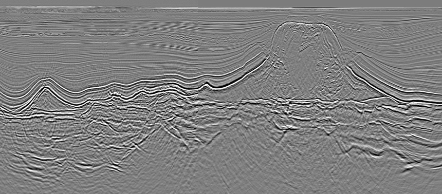
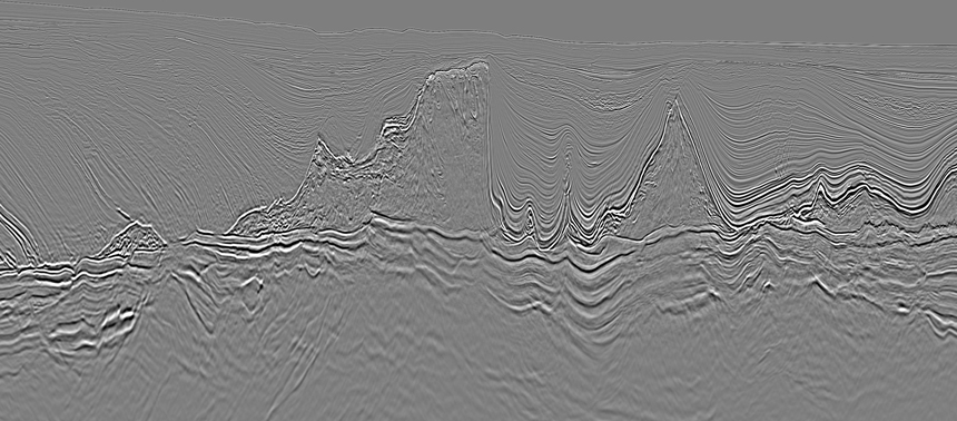
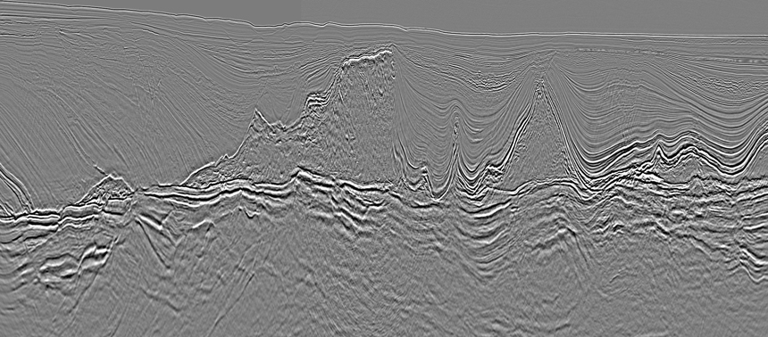
In the slider images below, a significant image improvement is observed through the application of the new workflow to 3D seismic data from the Santos Basin. This allows interpretation efforts to be concentrated on areas with highest reward potential. The process also provides a better understanding of acquisition geometry limitations and their impact on subsurface illumination, which in turn enables the real-time design of acquisition configurations for maximum illumination at target level.
PGS Santos Vision is a reprocessing project covering 35 000 sq. km of data from the Santos area. Area 1 deliverables are available now.
Visit us at SEG booth #1034 to find out more about our imaging technology and the Santos Vision product.
Contact a PGS expert
If you have a question related to our Imaging & Characterization services or would like to request a quotation, please get in touch.