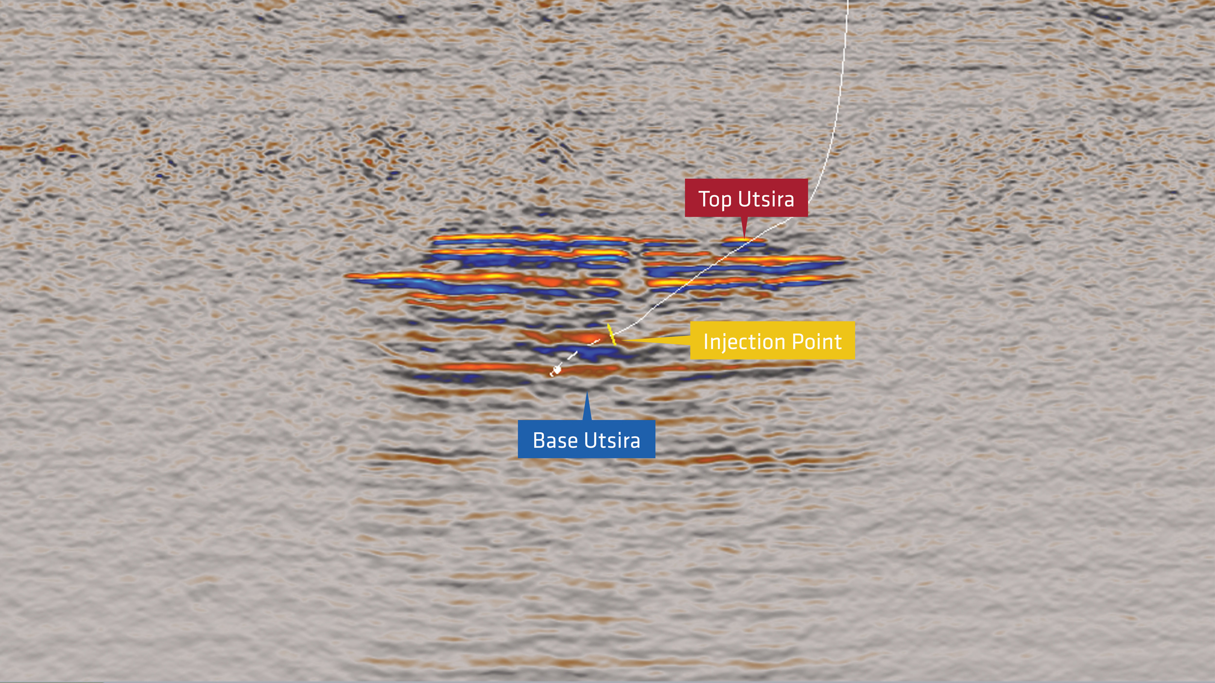
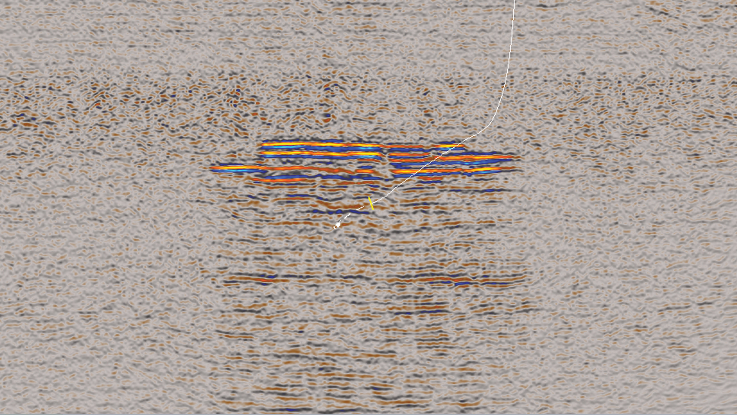
Broadband Processing Improves CO2 Monitoring

Broadband Processing Improves CO2 Monitoring

Sleipner, North Sea

PGS has a close collaboration with Equinor in the long-standing monitoring of the Sleipner CO2 storage site. Broadband reprocessing reveals new detail in the CO2 plume migration paths and aids the assessment of storage performance and the trapping mechanism


Location

Location
Sleipner, North Sea
Data acquisition (in this study)
1994 and 2008
Data type
Hydrophone
Field owner
Equinor
Survey type
CO2 monitoring

The Sleipner natural gas field, situated in the Norwegian sector of the North Sea, is the world’s longest-running industrial-scale CO2 storage project. The CO2 injection commenced in 1996, inserting almost one million tonnes (MT) of CO2 per year into the Utsira Formation, a relatively shallow, up to 250 m thick, saline aquifer with 35-40% porosity and > 1 Darcy permeability. By 2020, over 18 MT of CO2 was securely stored. The Sleipner CO2 storage project is regulated by Norwegian law. The monitoring program aims to track the storage performance, understand the CO2 migration and trapping mechanisms in the storage reservoir, and also monitor any changes in the overburden.

Challenge

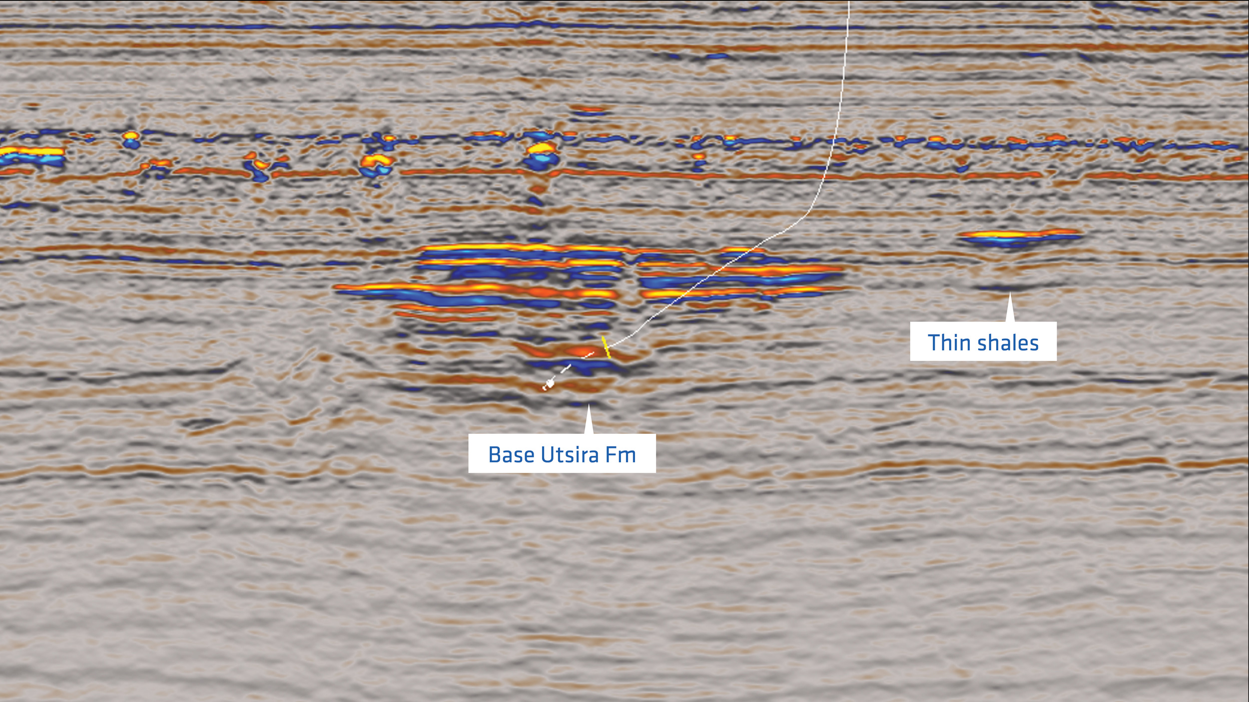
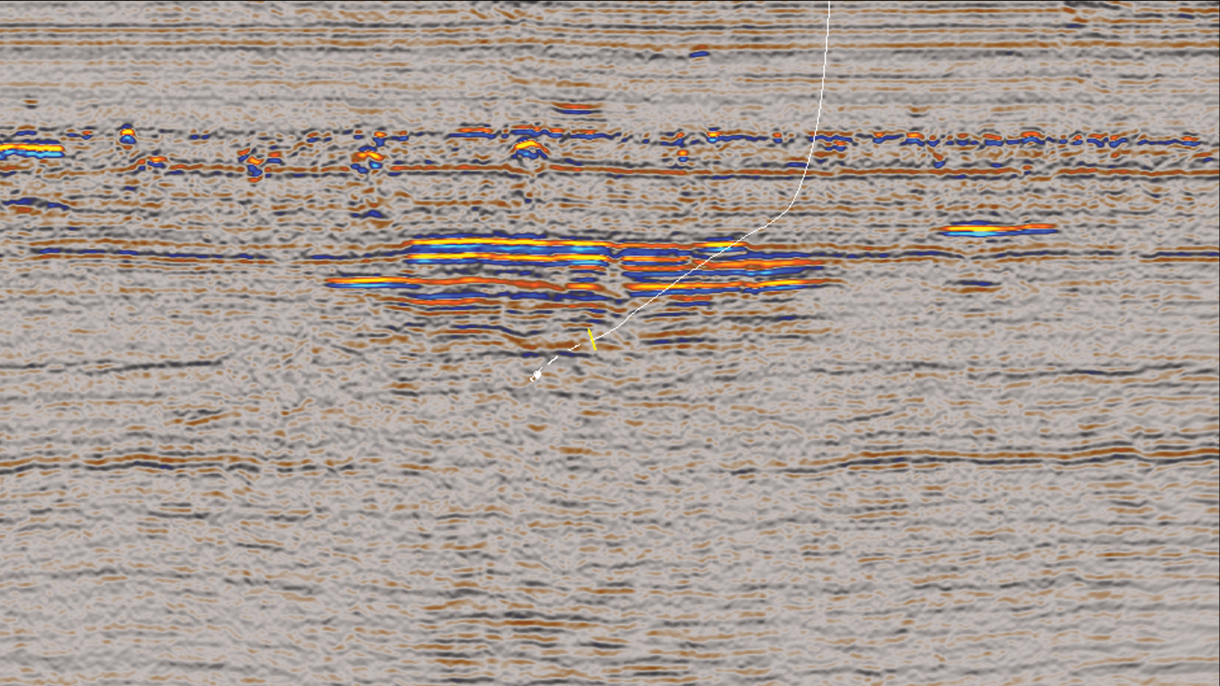
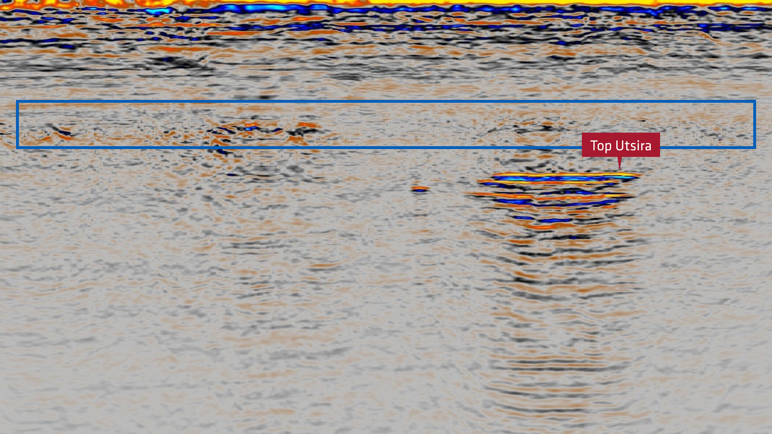
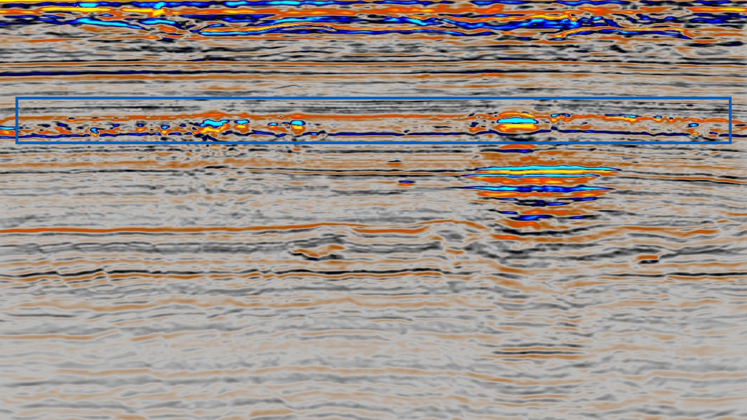
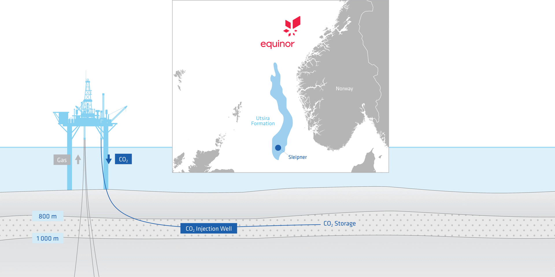
CO2 stored at Sleipner accumulates at the top of the Utsira Formation and beneath the thin shales within it. On vintage seismic data, it was difficult to predict the growth and migration of the CO2 plume, as the base and the structure within the Utsira Formation were almost invisible. The lateral migration of CO2 increased by up to 200-300 m from 2016 (white polygon) to 2020 (pink) with growth in the north, south, and west.

Solution

Processing
2020 reprocessing with broadband techniques
Demultiple
Full 3D demultiple
Pairwise 4D binning
To optimize repeatability
Velocity model building
Warping to correct for CO2 anomalies

The 1994 base survey was designed to cover the Top Utsira Formation as it was assumed this would define the maximum possible extent of the CO2 plume. The rate of CO2 migration was predicted to be in the order of 100 m per year, however, 4D seismic monitoring has indicated a migration speed of up to 300 m per year when the CO2 crosses a 'saddle point' and migrates towards a new structural high. In 2008, the data acquisition area was defined by the anticipated, at that time, CO2 plume extent. In 2020, a new monitoring survey extended coverage to the west, to cover another structural high outside of the primary anticline, because of the further westward expansion of the plume.

Correcting the Velocity Model to Account for CO2 in the Reservoir

Original velocity model
Updated velocity model after warping

The same velocity field was used to image the baseline (without CO2) and monitor surveys. However, sound travels at a different velocity with increased levels of CO2 so to correctly image the structures after CO2 injection, the original velocity model was modified using a simplified ‘warping’ technique. The result was a more reliable image, with improved gather flatness within the CO2 plume, better delineation and separation of the CO2 layers.

Results

Base Utsira and Skade Formation Better Imaged with Broadband Reprocessing

2008
2008 Data Reprocessed in 2020

There is a clear uplift in the 2020 processing. The base Utsira Formation reflector and the underlying Skade Formation are much better imaged, these horizons were almost invisible on the old data. This permits more accurate 4D time-shift estimates. It is also now possible to track thin shale layers within the Utsira Formation, making it easier to predict and track future growth of the CO2 plume.

4D Difference Datasets Track Development of CO2 layers

1994-2008 4D Difference
1994-2008 4D Difference 2020 Reprocessing

CO2 stored at Sleipner accumulates in nine interpretable layers. The most straightforward way of assessing the migration of the CO2 plume is to use the 4D difference datasets to track developments in the different CO2 layers. Good vertical and horizontal resolution is essential for reliable interpretation of the 4D difference. The new dataset offers significantly better definition of the deeper layers, where CO2 has been historically very difficult to image and interpret.

Repeatability and Resolution is Key for Accurate Overburden and CO2 Monitoring

2008 Stack After CO2 Injection
1994-2008 4D Difference

Small natural pockets of shallow gas in the overburden add to the complexity of CO2 monitoring as the shallow gas could be misinterpreted as CO2 leakage. In this case of poor geometrical repeatability between base and monitor survey, imaging of these strong shallow gas reflections was different and caused strong leakage on the 4D difference data. It is therefore essential to have good repeatability between the base and monitor surveys to increase the confidence in mapping the CO2 migration paths.

Results

The improved bandwidth of the 2020 processing leads to better imaging of the base Utsira Formation, improved definition of intra-Utsira Formation shales, and superior imaging of the deeper layers of the CO2 plume. Geometrical repeatability is important for CO2 reservoir and overburden monitoring and broadband acquisition and processing increases the resolution needed to reveal new details of the CO2 plume movement.

Find Out More

Talk to our experts, select one or more options