The Sabah Trough provided a new play opener with the recent Tepat discovery which lies within the footprint of our massive Sabah MultiClient 3D. The expansion of the MultiClient 3D continues in Sarawak, targeting opportunities in the Tatua Grabens, West Luconia and North Luconia Province. Both clastic and carbonate reservoirs are being targeted further outboard the proliferous Central Luconia Carbonate Platform.
The vast multisensor Sabah MC3D survey provides the best opportunity to unlock the petroleum potential of the enticingly prospective offshore Sabah province. It was the first 3D MultiClient survey in Malaysia and is one of the largest in the world, with over 50 000 sq. km of high-quality 3D data already in our library.
Sabah multisensor 3D data is ideal for both optimized infill development and exploring new opportunities in established plays in this exciting hydrocarbon province.
The phased acquisition approach added a host of new prospective areas over the inboard trend to our initial coverage of the outboard basins. The area comprises Miocene-Pliocene turbidite complexes, reservoirs trapped in complex fold and thrust structures, and stratigraphic settings.
The Sabah MC3D sets a benchmark for high-quality regional datasets that can improve understanding of the regional petroleum systems and also allow prospect-scale AVO analysis of prospects and leads within the entire offshore Sabah Basin.
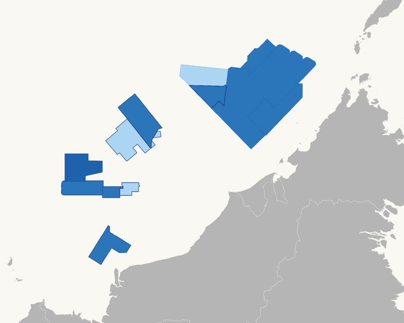
Further south along the Borneo coastline lies Sarawak, where a second significant MultiClient project was initiated in 2021. It includes Phase 1 (8 400 sq. km), Phase 2 (13 100 sq. km in processing), and Phase 3 (7 700 sq. km in processing), totaling 29 000 sq. km. This new multisensor 3D data in Sarawak will help better understand the distribution of Miocene-Pliocene clastic systems from the Rajang Delta and allow accurate mapping of the Mid-Miocene unconformity, deeper fault systems, as well as the pre-MMU cycles I-IV sediment distribution.
Data Library