

Defined as Egypt West Mediterranean Sea, the area is bounded to the south by the mature onshore Western Desert basins and to the east by the prolific Nile Delta cone. This frontier area covers approximately 80 000 sq. km and the PGS data library is an excellent place to start an evaluation of its hydrocarbon potential.
Reprocessed 3D surveys and reprocessed legacy 2D seismic data, complement newly acquired long offset GeoStreamer 2D seismic, and also offer gravity and magnetic data. Total seismic coverage amounts to 37 500 km of 2D and 6 000 sq. km of 3D. Of this, around 8 000 km of 2D data provides well and field tie lines that link the prolific Nile Delta to the frontier exploration area further west.
All data will be available prior to the announcement of the first license round offshore west Egypt.
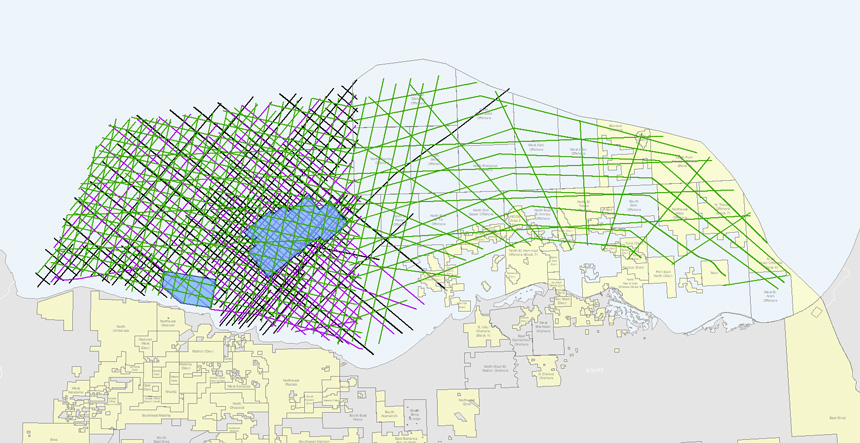 PGS MultiClient library offshore Egypt
Geological domains, from south to north, include a shelf zone with two distinct south-north trending canyons and a narrow Transform Margin. North of the Transform Margin, the area can be divided into three parts including the Mediterranean Ridge to the west, the Herodotus Basin and the Nile Delta extension to the east.
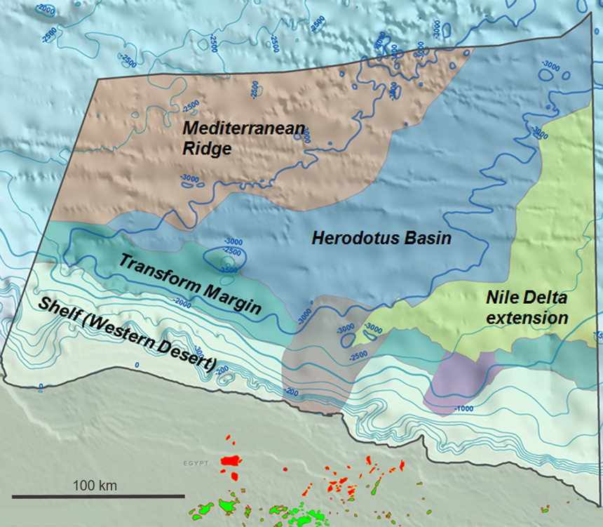 The offshore area has been subdivided into six offshore geological domains based on seismic interpretation.
The gravity and magnetic data provide strong indications for the continental/oceanic crust boundary; putting the entire Shelf, Transform Margin and both canyons on continental crust. Consequently, all leads present across these three geological domains are located on continental crust. Within the basin, based on the gravity and magnetic study and the seismic data, one can confidently suggest a maximum sediment thickness of approximately 15 km, allowing a working petroleum system to be in place.
Through comprehensive interpretation, supported by a basin modeling study, several leads have been identified. Hydrocarbon source rocks include Oligo-Miocene biogenic gas and Early Cretaceous - Eocene source rocks.
Egypt West Mediterranean Sea contains all aspects relevant for a potentially prospective working petroleum system and it is rapidly attracting attention.
Find Out More
To find out more and arrange a more detailed discussion regarding Egypt West Mediterranean exploration opportunities, visit us at the Egypt/EGAS booth D42 at the Petex conference in London from 27-29 November 2018.
Or contact amme.info@pgs.com