

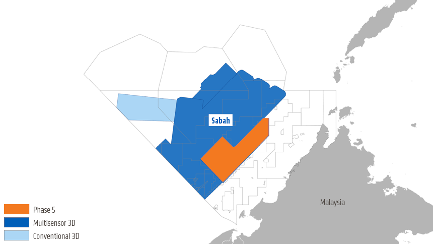
Final imaging products are now available on all parts of the giant Sabah MultiClient project, enabling AVO analysis of prospects and leads within the entire offshore Sabah Basin. Phase 5 acquired by PGS in 2020 brought total coverage to 47 000 sq. km.
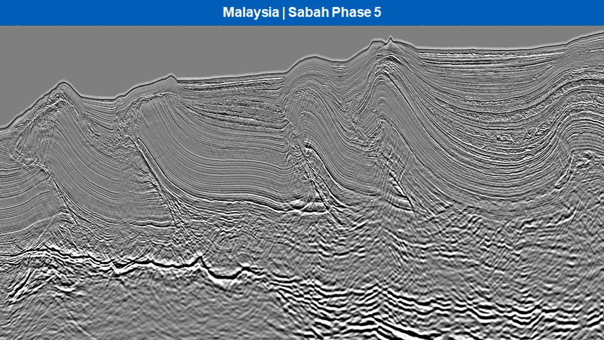
Commenting on the newest data focused on the inboard trend, Tad Choi, PGS Sales & New Ventures Manager for Asia says, “The new, fully AVO-compliant dataset for Phase 5 will improve understanding of the complex geology across the Sabah Trough and the Fold and Thrust Belt terranes, enabling advanced QI workflows to derisk reservoir presence and variability.”
Focus on the Inboard Trend
Phase 5 covers the inboard trend of the Sabah basin, providing excellent imaging of Miocene-Pliocene turbidite complexes where reservoirs are trapped in the complex fold and thrust structures, as well as stratigraphic settings. This structural trend has produced many discoveries.
The Sabah project continues to expand on the expectation of new licensing opportunities soon offshore Malaysia. The consortium partners are planning further shallow-water acquisition inboard in 2021.
Find out More
The 2021 Malaysian Bidding Round (MBR) has just been announced with several of the blocks on offer fully covered by the Sabah MultiClient survey. To de-risk and explore these prospective blocks with multisensor acquired broadband data in hand:
- Contact PGS to arrange a data viewing
- Ask for details of the Sabah 2021 shallow-water extension
Contact a PGS expert
Please contact a member of our Asia team for more information.