

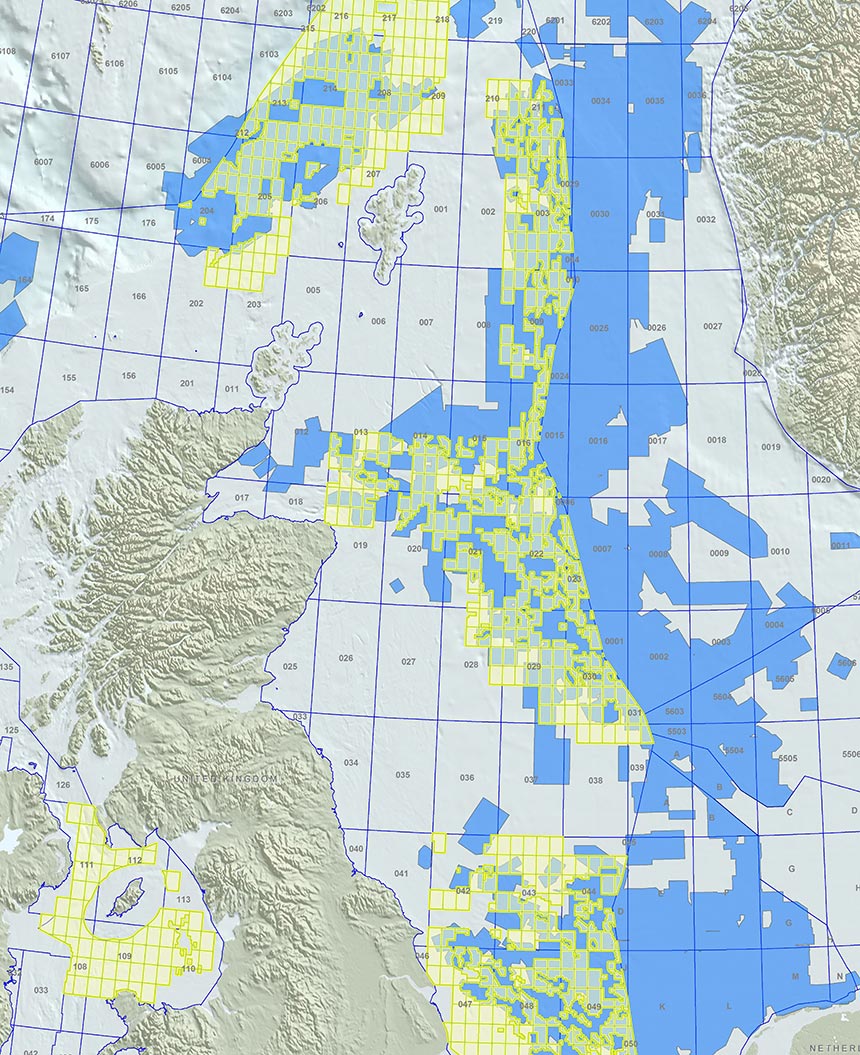
PGS data covers nearly 80% of the open blocks being offered in the UK 30th licensing round. These surveys provide an excellent foundation for thorough evaluation of the mature areas on offer.
Approximately 59 000 sq. km of 3D seismic data, comprising GeoStreamer and conventional 3D, MegaSurvey and MegaSurveyPlus datasets, covers or partially covers 650 of the 813 blocks confirmed by the UK Oil and Gas Authority for the UKCS 30th licensing round.
Now, more than ever, access to the best available data is essential to application success.
As the evaluations for the 30th Offshore Licensing Round begin, the availability of modern, true broadband seismic data helps to highlight the remaining prospectivity of the mature North Sea and investment in high-quality data will be recognized in license application marking criteria.
Modern PGS seismic data provide the perfect starting point to define, resolve and characterize the many of these undrilled targets.
For more information or to arrange a viewing, please contact mceurope@pgs.com or call +44 1932 37 62 01.
 Viking Graben: Regional depth imaging provides high-quality delineation of structural features and improved definition of stratigraphic detail
 Central Graben: Enhanced imaging from shallow stratigraphic plays to deeper sub-salt structures
Contact a PGS expert
If you have questions related to our business please send us an email.