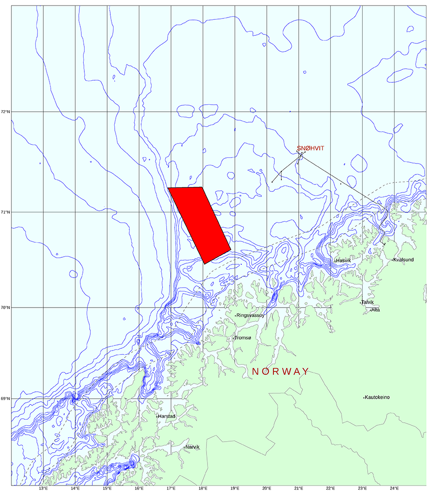
The survey is located in the southwestern part of the Barents Sea between the Senja Ridge and the Finnmark Platform, covering all the announced blocks in quadrant 7018.
Sanco Swift is undertaking the 3D GeoStreamer seismic acquisition. The Nordic Explorer, which is responsible for the EM part, arrived in the area last week, following rigging in Bergen. The first EM line was completed Saturday 19 August and almost half of the area has now been covered. This survey is part of a larger, prefunded EM MultiClient program in the Barents Sea.
Initial EM images will be ready for viewing by the end of October. To find out more please press the Contact Us button below.
Fast track 3D seismic data will be available in Q1 2018.

Coverage map PGS MultiClient 3D seismic and EM survey in Harstad Basin, Barents Sea
Seismic data is the best measure of lithology, however, it is complemented by EM which is more sensitive to changes in fluids. Correlation of velocity, acoustic impedance and resistivity data has been shown to improve drilling results in the Barents Sea.
Contact a PGS expert
Please contact a member of our Europe team for more information.