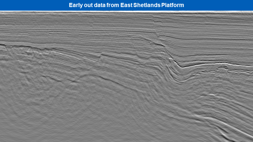
PGS has employed the latest acquisition and imaging technology to obtain high-quality 3D data on PGS20M02ESB that covers prospects and leads within the East Shetland area. The acquisition phase was completed in May 2020 and early out seismic data is now available for viewing.
Final processing will provide high-resolution PSDM seismic data to enable mapping of the fault systems and the Brent sandstone to evaluate the HC potential.
The main reservoir levels are the Triassic Cormorant Formation and Jurassic Brent Group. The structural definition below BCU will be important to understand the source migration pathways of the Kimmeridge Clay into the structural fault blocks, which are the principal trapping mechanisms.
3D GeoStreamer acquisition with a wide-tow triple source has provided a high-density dataset covering key areas of the East Shetland Platform. This is currently being processed using state-of-the-art imaging techniques with a workflow that includes Complete Wavefield Imaging (CWI). Targets in the basin and on the platform will be imaged using anisotropic TTI Kirchhoff PSDM.
Find Out More
Contact europe.info@pgs.com or your PGS account manager to arrange an early data show, or discuss other areas for UK 32 Round licensing.

Contact a PGS expert
Please contact a member of our Europe team for more information.