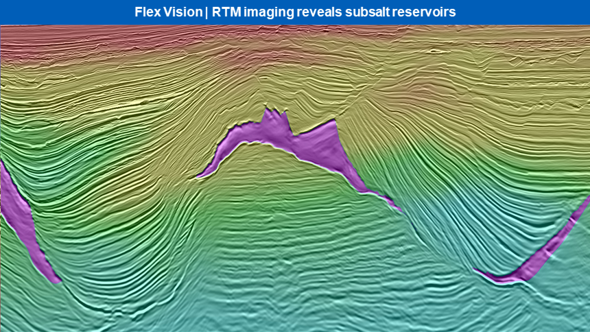
New data unlocks opportunities adjacent to existing discoveries, to enable infrastructure-led exploration in an area of the Gulf of Mexico that has been producing oil and gas for over two decades. Salt, the biggest challenge for exploration on the Flex Trend, is resolved with high-quality depth imaging and improved velocity control.

Flex Vision Program
The final data from the Flex Vision program demonstrates striking improvements in image quality, resolution, bandwidth, and geologic accuracy. The data rejuvenation process started from field tapes and applied the latest broadband imaging techniques and workflows, from data conditioning, noise, and multiple suppression, to new model building and imaging algorithms. This has provided the most comprehensive and geologically sound dataset to date.
“For E&P companies interested in increased near-term, step-out potential from existing production facilities in the Gulf of Mexico, this dataset can help to unlock and pinpoint new prospects that can meet profitability requirements in today's oil market,” says Alastair Lewis, PGS VP Business Development for North and South America.
Available Products
The seamless Flex Vision rejuvenated dataset covers 727 blocks (approximately 17 000 sq. km) over the mature Shelf and Shelf Break areas of the US Gulf of Mexico, from Vermilion in the west to Grand Isle in the east, along with northern portions of Garden Banks and Green Canyon. High-resolution Kirchhoff and least-squares RTM products are now available.
Find out More
Contact your PGS account manager or mail us at nsa.info@pgs.com for more information or to schedule a data show.
Contact a PGS expert
Please contact a member of our Gulf of Mexico team for more information.