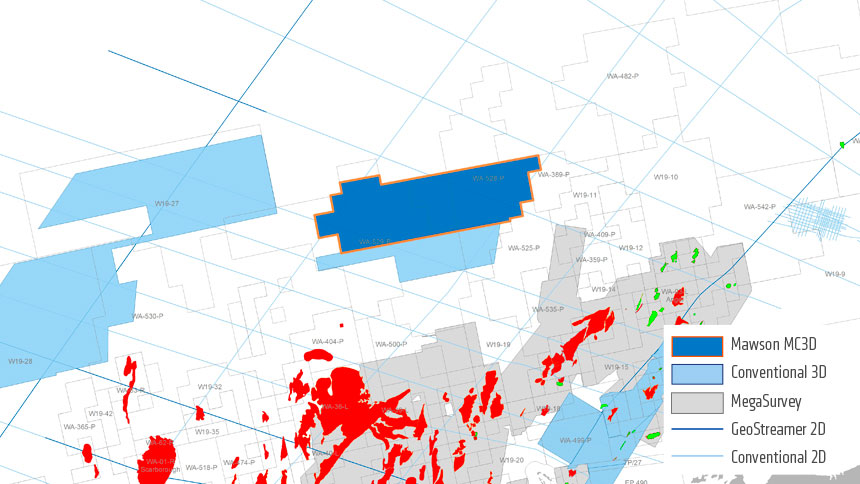
The Mawson 3D survey applied a modern, triple-source GeoStreamer 3D survey design and delivers seismic data with prestack AVO/AVA fidelity to image the deep Triassic fault blocks of the Outer Exmouth, Carnarvon Basin.
This highly efficient MultiClient 3D survey was acquired over 10 weeks during March and April 2019, with initial fast track data delivered to prefunders in almost realtime, and with suitable quality to enable early interpretation.
Processing and imaging of the full integrity data are now complete. This is an area that PGS believes will be relevant for 2020 licensing.
“The survey offered an extremely fast method of delivering a new understanding of held acreage for license-holders while expanding coverage to vacant acreage that may provide future licensing opportunities. It made sense commercially and adds a greater understanding of the geological settings. This was made possible due to the integrated approach PGS took to project planning, acquisition, and imaging,” explains Rick Irving, PGS Vice President for New Ventures and Sales, Australasia.
The North Carnarvon Basin is a frontier area that contains a variety of structural/stratigraphic trap styles within the prospective Triassic fault blocks and Upper Jurassic sediments. The area is on trend with existing gas accumulations to the south and close to existing infrastructure.
Find Out More
To arrange a data show of the Mawson MC3D data, or talk with our experts about acquisition, imaging or integrated projects in Australia, contact ap.info@pgs.com

Contact a PGS expert
Please contact a member of our Asia team for more information.