

GeoStreamer data from the Barents Sea is reprocessed using SWIM to provide excellent resolution at shallow depths and reliable AVO attributes.
GeoStreamer data, even if originally acquired for exploration purposes, can be reprocessed to generate high resolution images of the shallow subsurface and used for Shallow HAZard (SHAZ) assessments.
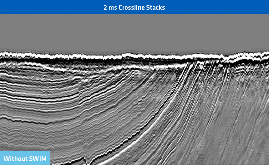
SHAZ processing aims to produce high resolution images of the overburden by processing at a 2 or 3 ms sampling rate (2 or 3 m in depth) and on a dense image grid. GeoStreamer data is the best input for such processing as it is characterized by high signal-to-noise and uncompromised receiver deghosting.
GeoStreamer PURE consists of four unified 3D datasets in northwest Europe and the Barents Sea exclusively using GeoStreamer 3D data. The data has been merged and reprocessed using advanced imaging workflows to create a premium product.
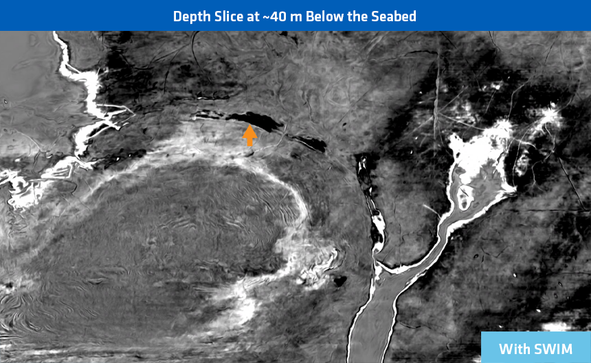
In the example below from the Barents Sea the GeoStreamer data has been reprocessed using Separated Wavefield Imaging (SWIM) for the first few hundred meters and then combined with conventional Kirchhoff Q-migration image deeper in the section.
SWIM effectively removes footprint issues in the shallows, which is a major drawback of conventional seismic surveys. The optimized tools and workflows allow full integrity processing at 2 ms in order to produce the highest possible resolution images.
The detection of shallow gas and the AVO characterization of the shallow reservoir are the obvious benefits in this SHAZ data example.


Contact a PGS expert
If you have a question related to our Imaging & Characterization services or would like to request a quotation, please get in touch.