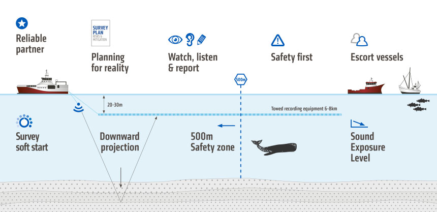
Understanding how seismic surveys may affect ocean habitats is key to minimizing the disturbance potentially caused by our operations. Months ahead of a seismic vessel arriving at the location of a survey, our scientists carry out careful analysis and planning. We collaborate closely with regulatory authorities and other stakeholders and the process is strictly governed by law. No survey takes place without an approval process and a permit in place. This may include direct dialog with potentially affected parties, such as fishing communities, before and during a survey.
We are committed to:
- Carefully planning and executing surveys to minimize any disturbance
- Immediately ceasing operations if marine mammals are observed in close proximity
- Respecting local communities and fishermen
- Not throwing anything overboard and leaving nothing behind
The potential for disturbance of marine life and habitats is directly related to the generation and transmission of the seismic sound pulses that are used to image the geological structures beneath the sea floor. This technique, which is very similar to medical ultrasound, has been used for close to a century. Today, the signal is generated by compressed air sources.
We have committed significant resources towards developing a new generation of seismic sources: eSeismic is a method for generating continuous signals with lower amplitudes, while marine vibrators may offer an alternative to compressed air. Both the PGS eSeismic method and our preferred design for a marine vibrator are in advanced stages of development (see case study).
