

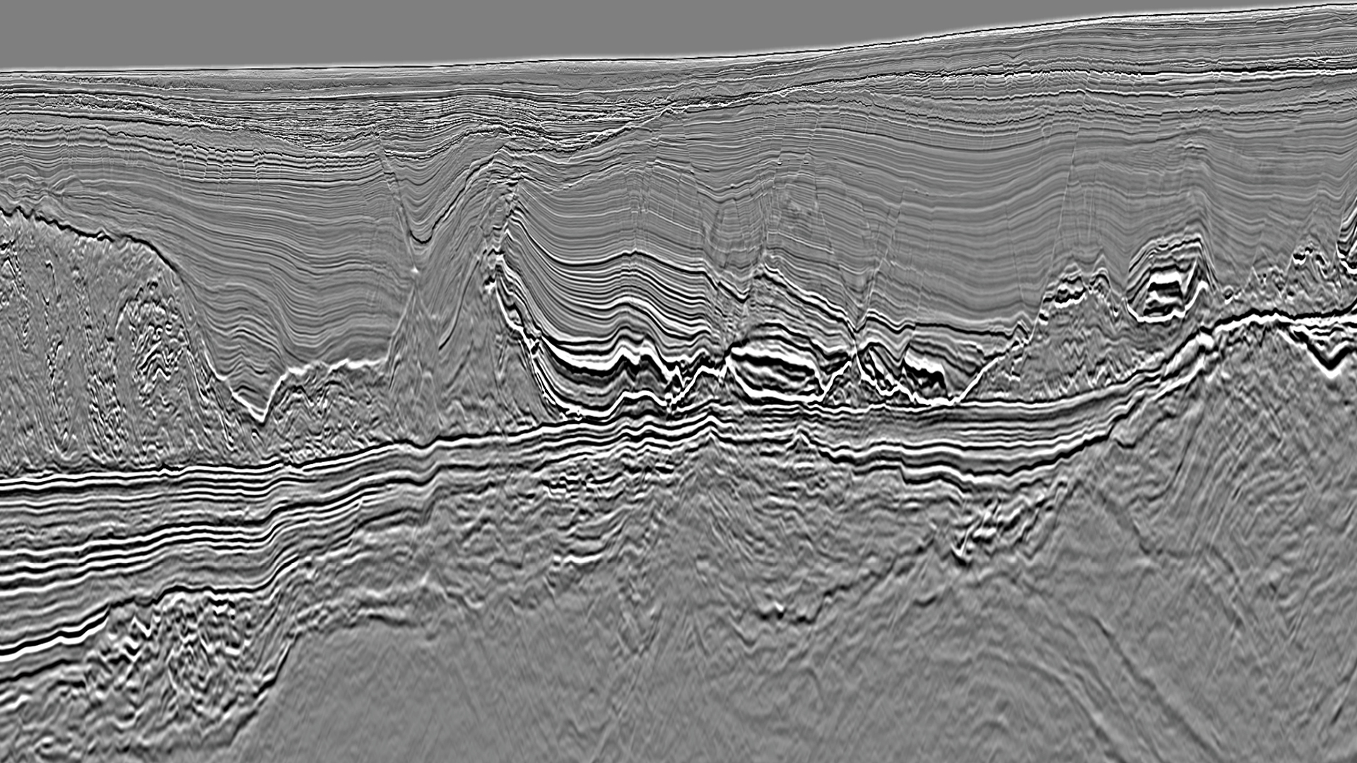
A vertical seismic section through the Campos Deepwater GeoStreamer X dataset. This image demonstrates the presence of thick syn-rift sediments deposited over a highly faulted basement. Some of these faults may serve as fluid migration pathways to carbonate buildups that have formed atop basement-related structural highs. The regionally extensive Albian salt provides sealing capability for the presalt petroleum system.
Tailoring Acquisition to Deliver Azimuthal Coverage
Most of the survey area is covered by legacy 3D seismic dating back to the early 2000s. Typically, the legacy surveys were acquired in an east-west orientation using a dual vessel Continuous Long Offset (CLO) approach giving a maximum offset of 8 300 m. To provide better spatial and azimuthal sampling and longer offsets, a new second azimuth was acquired in a north-south orientation in 2020 and 2021.
The new north-south azimuth was acquired with PGS’ proven GeoStreamer broadband technology. Leveraging the impressive towing capabilities of the Ramform Titan-class vessels, a spread of 14 cables x 100 m separation x 10 050 m length was deployed. This configuration set new industry records for overall spread dimensions and for the total amount of cable deployed by a single vessel in Brazil. While delivering the long-offset data needed to image the presalt targets, the configuration minimized the number of shot points per square kilometer, reducing any potential for environmental impact. The azimuthal coverage of the combined surveys can be seen in the rose plot above.
Imaging Workflows Customized For GeoStreamer X
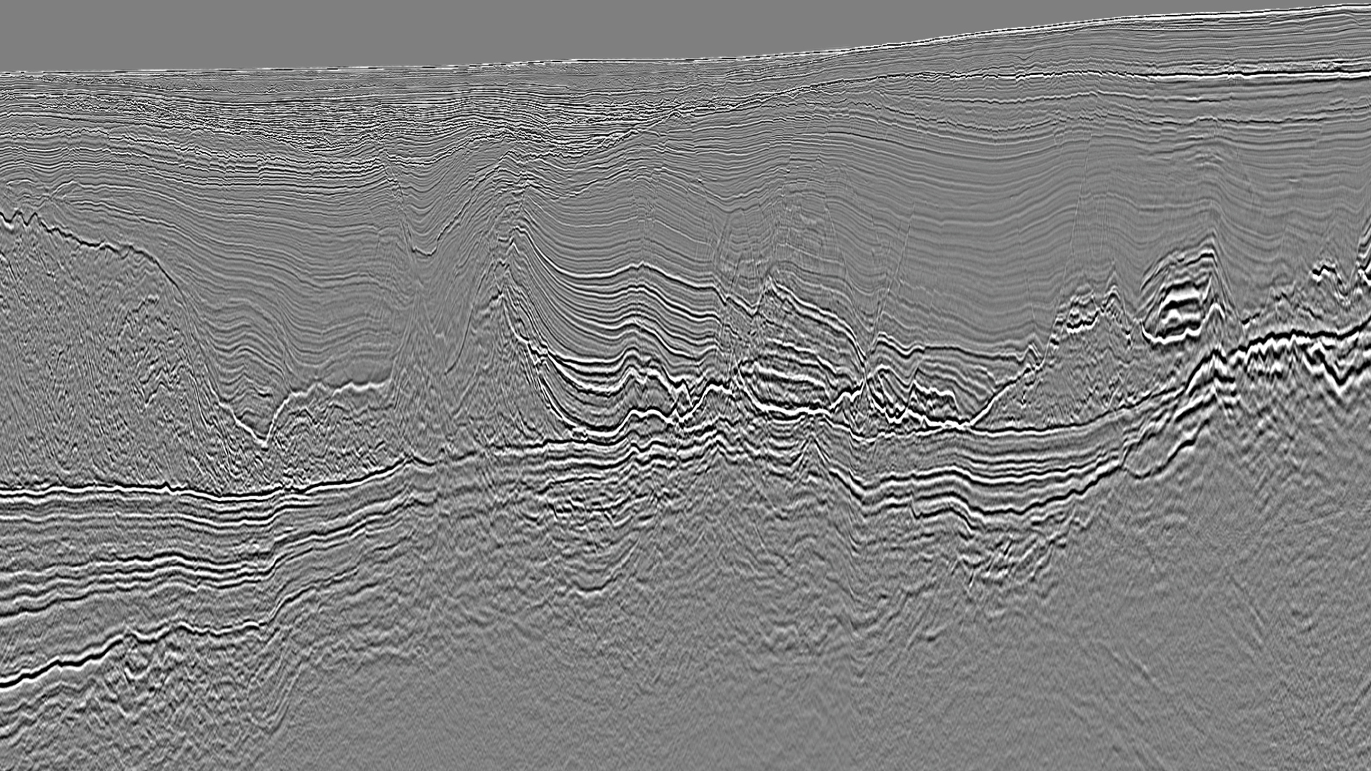
The data quality of the Campos Deepwater GeoStreamer X dataset has been optimized using a comprehensive processing and imaging strategy, as demonstrated by the comparison with the legacy data below. The legacy data has been enhanced using a 3D deterministic deghosting approach to replicate the wavelet fidelity achieved from the new broadband GeoStreamer data. Removing unwanted surface ghost effects from both azimuths enabled subsequent processing, such as demultiple, to be applied effectively yet robustly, thereby extracting maximum resolution from the data. The enhanced resolution supports accurate interpretation and reduced uncertainty when assessing prospectivity across the target intervals.
The velocity model has been developed using advanced anisotropic approach which captures detail across the stratigraphic intervals. High-resolution wavelet tomography (PGS hyperTomo) was utilized in a dual-azimuth sense to construct a robust long-wavelength background velocity model. The Albian carbonate units and layered evaporite sequences were accurately interpreted benefitting from improved wavelet resolution, demonstrated in the depth slice below, to correlate units. Leveraging the robust background velocity trend, the model was enhanced to high wavelength utilizing Full Waveform Inversion (FWI), as seen in the comparison below. The multiazimuth, long-offset data further aided velocity model optimization.
Supporting Block Nominations
The Campos Deepwater GeoStreamer X dataset can provide Kirchhoff Migration and also Reverse Time Migration products. These complementary migration technologies both deliver amplitude-preserved prestack image gathers to support quantitative interpretation workflows in addition to structural analysis. PGS investigation across the dataset has identified amplitude-supported anomalies that have analogies to known discoveries within the area. PGS utilized this analysis to support new block nominations, which ANP has since announced will be taken forward as offered acreage in upcoming license rounds.
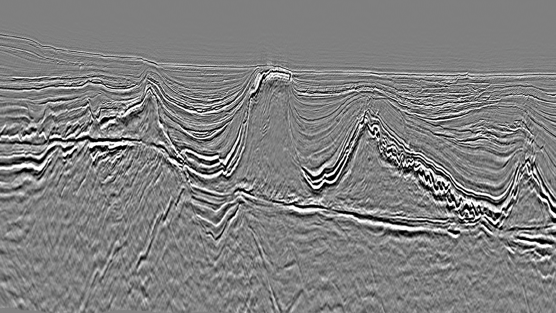
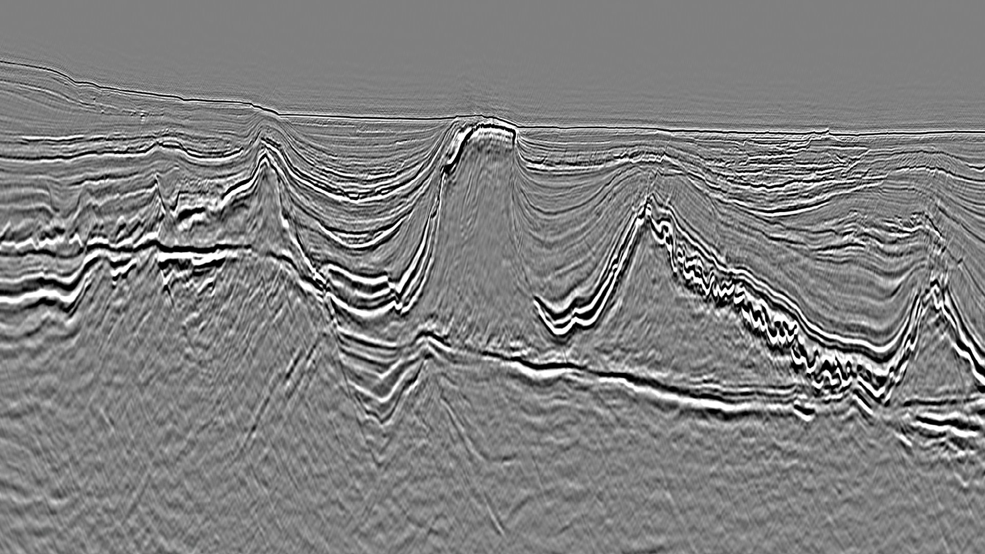
Delivering a high-resolution velocity model supports accurate and impressive imaging of these folded Albian carbonates.
Contact a PGS expert
Please contact a member of our Brazil team for more information.