
Contact a PGS expert
Please contact a member of our Asia team for more information.
Multisensor broadband data enables explorers to interpret both new prospects and deeper geology.


Northwest Borneo offers a number of exploration play types within its Tertiary reservoirs across various geological terranes. One of the main reservoir targets in Sarawak is thought to be Miocene carbonate platforms and pinnacle reefs (Luconia Platform) developed on the mid-Miocene unconformity. In the Sabah Basin, the main reservoir target are the turbidite clastics within the Sabah Fold and Thrust Belt.
Modern broadband multisensor seismic data reveals the possibility of a deeper, clastic play in pre-MMU syn-rift sediments across both these basins. These were very poorly imaged on legacy 2D seismic but now the petroleum potential of both horst and extensional tilted fault-blocks plays can be clearly seen.
In the structurally complicated inboard area of Sabah offshore, there is a proven petroleum system in the fold and thrust belt with Miocene-Pliocene turbidites as the reservoir. The key risk in this area is the variability of the reservoir. It is crucial to be able to image the targets clearly in order to map sweet spots and delineate complex structures.
Further outboard in the Sabah Trough and Dangerous Grounds one finds Miocene carbonates and syn-rift plays. The Tepat discovery in 2018 and appraisal in 2022 in the deep waters of the Sabah Basin opened up a new and exciting carbonate play in the Sabah Trough.
The multisensor Sabah and Sarawak MultiClient 3D broadband data has enabled explorers to interpret both new prospects and deeper geology. This was a challenge on legacy data. The multisensor imaging creates new and exciting opportunities and allows explorers to make better decisions, derisk their prospects, and increase the economic value of their portfolio.
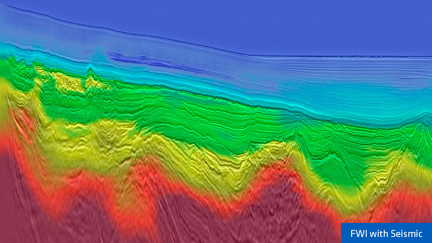
Multisensor streamer acquisition provides the low-frequency content and deep penetration required for advanced model building and full waveform inversion (FWI) to refine the velocity model.
Regional-scale seismic cross-section showing elements of the Sabah fold-belt, Sabah Trough and subducting Dangerous Grounds stratigraphy.
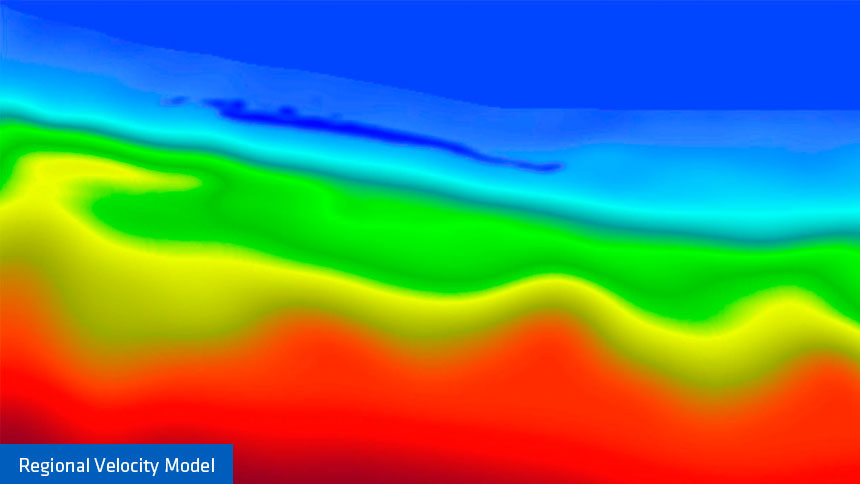
Velocity building and imaging using conventional tomography tools are often regional in scope and fit for purpose for exploration. However, reprocessing and imaging using more advanced sequences provide significant uplift.
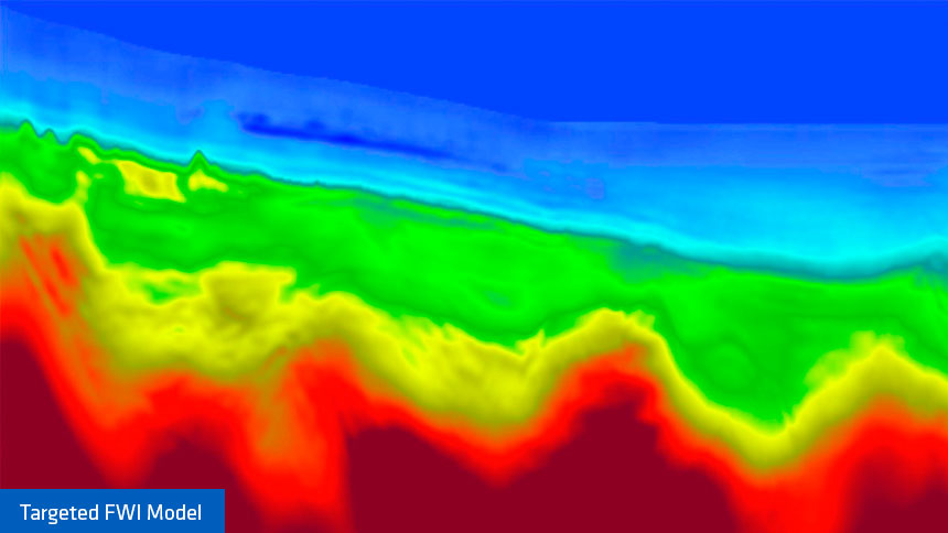
The images below demonstrate the value of using a more costly, technically advanced model-building and imaging workflow when imaging specific targets.
Detailed velocity, Q, and anisotropic models were the key to properly imaging and derisking a potential prospect. The information extracted from the migrated image but also from the high-resolution updated models can be later used for in-depth analyses including targeted structural interpretations, seismic inversion, and quantitative studies.
Please contact a member of our Asia team for more information.