

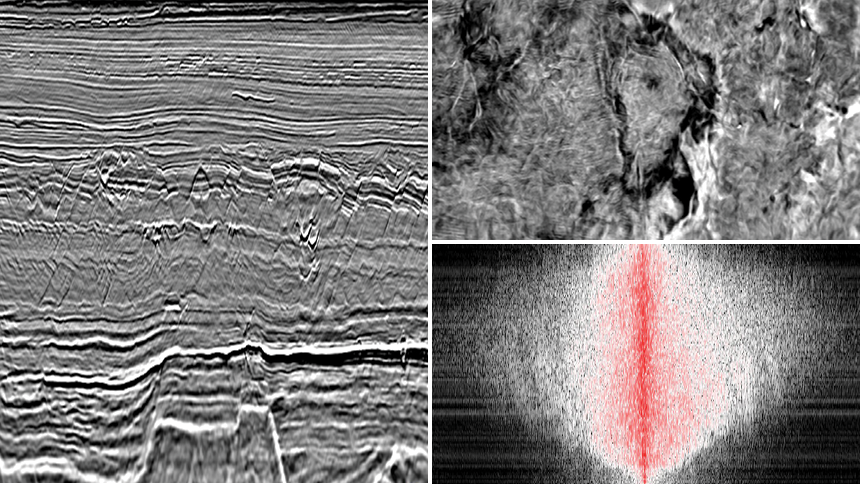
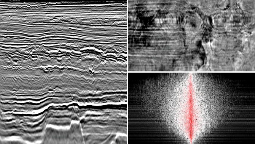
Least-squares migration (LSM) is a sophisticated form of depth migration where the image reflectivity is updated to have uniform amplitude representation (illumination irregularities are healed) and high spatial resolution (sharper fault resolution and steep dip resolution).
- Works with all PGS imaging algorithms and for both towed streamer and OBN data
- All PGS LSM solutions can produce pre-stack angle domain products to benefit quantitative interpretation (QI)
- Implementation flexibility either by iterative updates to reflectivity in the data domain, or multi-dimensional deconvolution in the image domain
- Optimizes separated wavefield imaging (SWIM) and full wavefield migration (FWM) where the contributions from multiples may be beneficial to imaging
Note that all LSM solutions update the reflectivity model of the subsurface and do not update the velocity model. For simultaneous updating of both velocity and reflectivity models, PGS Ultima combines both FWI and LSM into a single solution.
PGS has a comprehensive suite of LSM solutions for target-specific challenges. Each implementation produces both pre-stack gathers and stacks and incorporates anisotropy. PGS LSM solutions can also be extended to accommodate FWM and SWIM to improve the imaging illumination, mitigate acquisition footprint, reduce the crosstalk and produce an enhanced shallow image of the earth’s reflectivity. 4D surveys with different acquisition geometries can be reconciled using a 4D LSM solution based upon cross-survey point spread functions.
LS Kirchhoff PSDM | Image domain improvement based upon modeled point spread functions (PSFs)
LS WEM | Data and image domain application with full wavefield version available that simultaneously images both primary reflections and multiples
LS RTM | Image domain improvement based upon modeled point spread functions (PSFs) and data domain improvement based upon iterative updates to reflectivity model
High-Resolution Insights At All Depths
Although LSM provides no updates to the velocity model it is often used in conjunction with FWI velocity models to yield powerful deep geological insights.
Contact a PGS expert
If you have a question related to our Imaging & Characterization services or would like to request a quotation, please get in touch.