Contact a PGS expert
Please contact a member of our AMME team for more information.
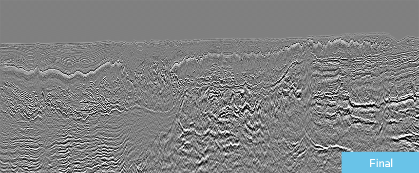
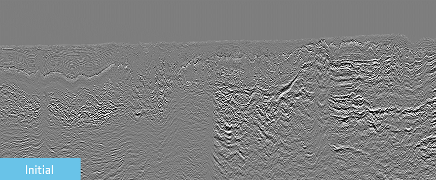
A targeted processing sequence has been applied to a number of large 3D GeoStreamer surveys in the Eastern Mediterranean Sea.


The processing workflow focuses on creating regional-scale high-resolution velocity models to image prospectivity in this challenging salt environment.
The data consists of a number of large 3D surveys from Lebanon, Egypt and Cyprus, covering an area of approximately 21 500 sq. km. A state-of-the-art pre-processing sequence, including the latest 3D demultiple techniques, was applied to each survey. This was necessary to tackle the multiple and noise challenges in this geologically complex region.
Unique PGS imaging and model-building solutions were applied where appropriate, including Full Waveform Inversion (FWI) for the post-salt model-building phase. Separated Wavefield Imaging (SWIM) was employed for the shallow water data, enhancing the imaging by using multiples to improve illumination and angular diversity.
Following this, an anisotropic depth velocity model building sequence was applied to each survey. To reveal potential presalt plays and reduce structural uncertainty, the intricate, often included and occasionally punctured Messinian salt bodies required special attention to ensure the depth velocity model compensated for these imaging challenges.
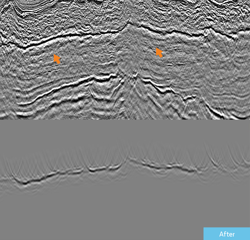
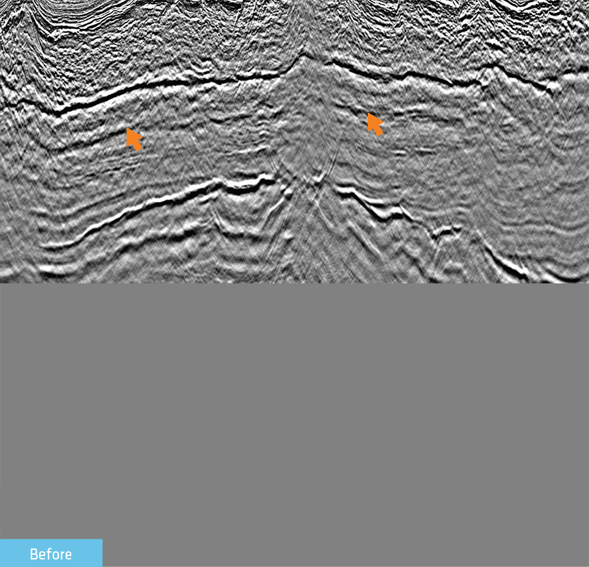
Cyprus depth image and velocity overlay. Final vertical velocity depth model over a beam depth image showing the pre-Messinian section and the carbonate buildups offshore Cyprus. The zoomed display shows a broadband Q-Kirchhoff depth image close to the ESM, showing details of the Messinian TOS and intrasalt sequences and their correlation to the BOS geometry using a constant flood velocity of 4200 m/s inside the whole Messinian salt layer.
Using a fully integrated model building flow enabled accurate imaging of the presalt reflectivity. However, the strong impedance contrasts found at the top and base salt created converted waves. These low-frequency coherent events were recorded in the seismic data and made presalt prospectivity delineation difficult.
PGS implemented an innovative workflow using a wavefield extrapolation modeling and removal technique to attenuate the converted wave ‘noise’, reducing exploration risk by revealing the presalt reflectivity.
The examples shown here demonstrate how PGS solves the geological challenges in the Eastern Mediterranean by delivering high-quality depth imaging using leading-edge seismic processing, advanced velocity model building and imaging, as well as novel and targeted workflows.
Please contact a member of our AMME team for more information.