Contact a PGS expert
Please contact a member of our Canada team for more information.
Exploration targets include Late Jurassic to Early Cretaceous fluvial to shallow marine sandstone reservoirs sourced by prolific oil-prone Late Jurassic marine shales.


A mainly extensional margin provides large structural traps and thick regional seals.
Potential producing reservoirs from Lower Cretaceous to Lower Tertiary are stratigraphically above the Kimmeridgian source rock super highway. PGS 3D data delineates play fairways from the Orphan Basin in the north to the Jeanne d’Arc Basin in the south. PGS 2D data is available for regional interpretation and basin analysis.
The existing fields and discoveries are often drilled into rotated fault blocks in the older section and adjacent to tilted half grabens.
2D GeoStreamer across the Bay du Nord and Harpoon Discoveries in the Flemish Pass Basin. Harpoon and Bay du Nord are drilled to the late Jurassic Tithonian Bodhran Formation with an estimated 800 MMBOE in place (2014).
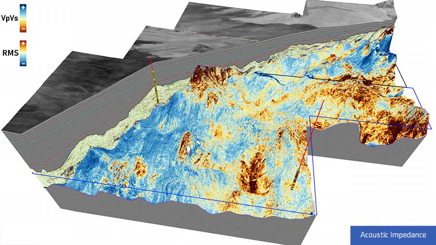
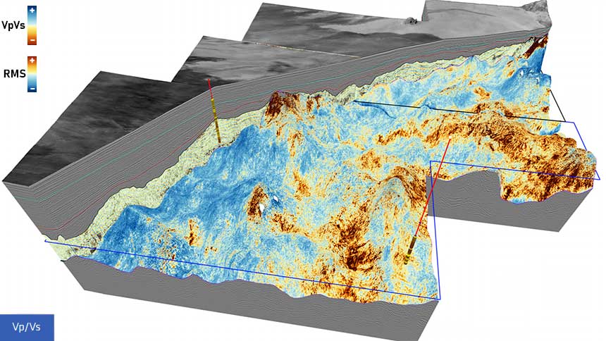
GeoStreamer provides broadband data, which is reliable for structural interpretation, seismic attributes and rock property analysis. The rift section is well-defined and seismic attributes in the Tertiary section make identifying stratigraphy and possible fluid effects very easy with the reliability of the broadband data. Recent work on seismic attributes has demonstrated fan geometries in the younger section of the Orphan basin and the northern portion of the Flemish Pass basin.
Fan Geometry from 3D GeoStreamer data in the Orphan Basin. AVO-compliant display of relative impedance demonstrates the fidelity of the data for reservoir definition and characterization in the Tertiary section of the Orphan Basin.
A single, continuous high-resolution seismic dataset will be available for licensing early next year, covering both the Tablelands and North Tablelands surveys and will provide a seamless high-quality dataset over 12 650 sq. km
The data will be helpful in identifying all the necessary petroleum system elements contained in the underexplored basins and provide the ability to tie them to discoveries in the producing basins. GeoStreamer data should also enable confident block evaluations for license rounds in Eastern Canada.
Please contact a member of our Canada team for more information.