

The July issue of The Leading Edge features a PGS article outlining how improvements in velocity model building in the major basins of the east Mediterranean Sea can help reveal regional prospectivity.
The main challenge for imaging subsurface structures in the area is the presence of the Messinian salt layer and its variable complexities. The process of optimizing the depth velocity models in the area has been limited by the acquisition geometry and the availability of well information.
To image the basins of the East Mediterranean, reliable depth velocity models must be built and this requires accurate determination of the complex salt top and base, as well as accurate estimation of their velocities.
FWI for Better Velocity Model Resolution
Since 2006, many 2D and 3D MegaSurveys using conventional and multi-sensor acquisition have been carried out across the area. Regional and relatively simple velocity models are used to image the Messinian salt layer extensions from offshore West Egypt to offshore Lebanon, passing by the Cypriot waters and the Eratosthenes Sea Mount. The data acquired includes shallow and deep water surveys, and technologies like Full Waveform Inversion (FWI) are applied to produce high resolution images for the shallow post Messinian section.
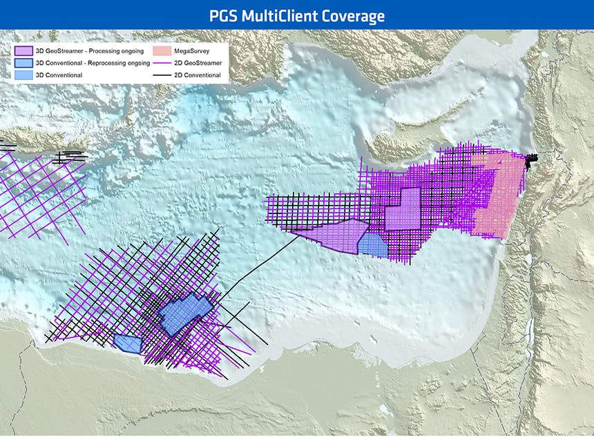 East Mediterranean map showing the PGS 2D and 3D blocks covered by MultiClient data.
SWIM for Improved Shallow Water Bottom Imaging
Shallow water imaging challenges such as acquisition footprint issues and low angle illumination are solved by imaging with multiples using dual-sensor data and Separated Wavefield Imaging (SWIM). The Messinian salt layer is modeled with a constant regional velocity, while the pre-Messinian section is modeled with a combination of velocity gradient models. The regional model building scheme introduces a good correction for the pre-Messinian structure and provides reliable MultiClient data ready for outlining new prospects.
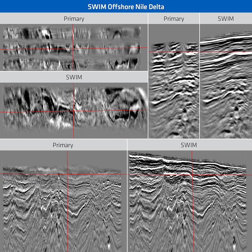 Primary and SWIM images displayed with a 45 degree angle mute in the shallow water offshore the Nile Delta.
Contact a PGS expert
Please contact a member of our AMME team for more information.